An area of the seabed north of Australia has been mapped in detail for the first time, revealing that large numbers of people could have lived there until it was inundated by rising seas
By James Woodford
2 January 2024
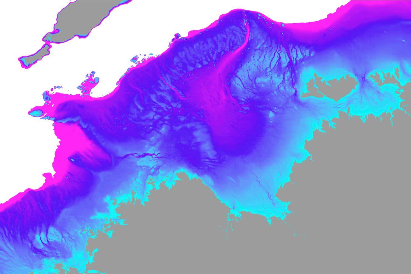
Blue and pink areas show what was once a large habitable region connected to north-west Australia, which is now submerged
Kasih Norman
An area of land north of modern Australia that was submerged by rising seas at the end of the last glacial period could have once been home to as many as 500,000 people.
Read more
The civilisation myth: How new discoveries are rewriting human history
Kasih Norman at Griffith University in Brisbane, Australia, and her colleagues have reconstructed the topography of around 400,000 square kilometres of land that is now covered by the Indian Ocean, known as the Northwest Shelf. Far from being uninhabitable, as was previously thought, the team says it was home to thriving populations of people for tens of thousands of years.
Advertisement
The study reveals features including an inland sea, similar in size to Turkey’s Sea of Marmara, as well as a vast freshwater lake along with gorges, rivers and escarpments like those that now exist in Kakadu National Park in the Northern Territory of Australia.
Norman says this flooded land has long been known about because of oil and gas exploration, but Geoscience Australia has recently released detailed sonar data, with each pixel representing an area of just 30 by 30 metres. “This is a high enough resolution to be able to talk about landscape features that were important to people,” she says.
The inland sea existed in a stable form between 27,000 and 17,000 years ago, the study found. A 2000-square-kilometre freshwater lake nearby was stable from 30,000 to 14,000 years ago. The lake would have been a vital refuge for people escaping the arid conditions of the Australian continent to the south.