Satellite images reveal how a subglacial lake erupted through the Greenland ice sheet – a phenomenon never witnessed before which could be driven by rising temperatures
By Madeleine Cuff
30 July 2025
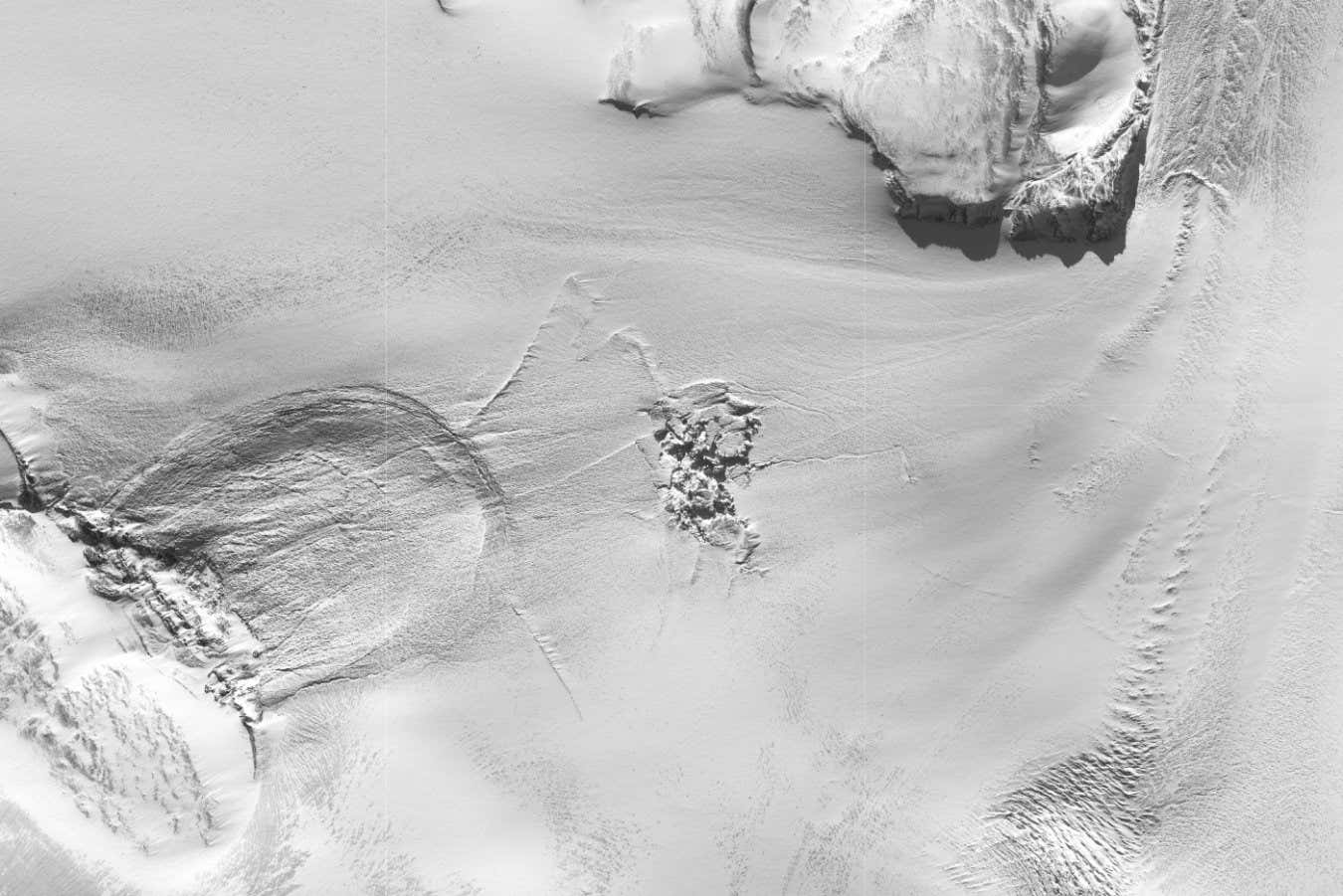
Satellite image of the subglacial lake region after the outburst flood occurred, showing the fracturing of the ice sheet
10.1038/s41561-025-01746-9
As Greenland’s glaciers melt, water usually drains to the bedrock below before flowing out to the ocean. But in 2014, a huge torrent of meltwater from a subglacial lake burst out of the surface of the Greenland ice sheet, leaving 25-metre mounds of ice and giant crevasses in its wake.
“We haven’t observed anything like this before,” says Malcolm McMillan at Lancaster University in the UK. “We know that lakes beneath Greenland drain. But what we’ve never seen before is this fracturing and the water actually erupting through the surface of the ice sheet.”
Read more
Geoengineering could save the ice sheets – but only if we start soon
Advertisement
McMillan and his colleagues began to investigate after spotting the sudden appearance of a crater 85 metres deep in the surface of the ice sheet, captured by satellite in August 2014. They used satellite data and numerical models to reconstruct what happened to cause the crater.
They found the crater had emerged after the rapid draining of a subglacial lake within a 10-day period in July and August 2014. About 1 kilometre downstream from the crater, the team spotted a huge disturbance of the ice where the water had emerged.
The team believes the water pressure in the subglacial lake had increased enough to force it back above ground through fractures in the ice, eventually bursting out of the ice sheet and leaving huge crevasses and ice towers in its path.